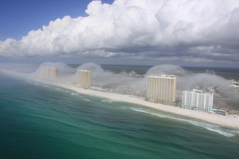
Fantastic Condo Wave Cloud Hits Florida Coast
Helicopter pilot J.R. Hott captured these breathtaking images showing low-lying clouds swooping over the high-rise buildings lining the beaches of Panama City in Florida. At a glance, it appears as though a tsunami is poised to crash over the city.
Meteorologist Dan Satterfield explains the phenomenon:
Cool air offshore was very nearly at the saturation point, with a temperature near 20ºC and a dew point of about 19.5ºC. The air at this temperature can only hold a certain amount of water vapour, and how much it can hold depends heavily on the temperature. If you add more water into the air, a cloud will form, but you can also get a cloud to form by cooling the air. Drop the temperature, and it can no long hold as much water vapour, so some of it will condense out and a cloud will form.
In this case, the air was cooled by lifting it about 50 meters over the top of the condos. A parcel of unsaturated air will cool when lifted at a rate of 1ºC per 100 meters. In this case, it probably cooled about 0.5 degrees C, but that was all it took! On the back side of the condos, the air slowly sinks back down and warms at the same rate. As it warms the air can hold more water vapour and the cloud evaporates and disappears!
J.R. Hott, the owner of Panhandle Helicopters, says that he sees this effect a few times a year. This one was one of the best, because many times it fogs in before he can get his chopper in the air to grab a snap.


No comments:
Post a Comment